
Exploring New Horizons: Sango Wildlife Conservancy
- bayleighmiles
- Jan 30, 2025
- 2 min read
In September 2024, Brandon, the ecologist and founder of Habitat Horizons, embarked on an exciting journey to the southeastern lowveld of Zimbabwe. This marked the beginning of a pioneering initiative: an oblique camera count aerial survey set to encompass an astonishing 60,000 hectares of conservation land.
It was in this very region, at Sango, that the seeds of Habitat Horizon were first sown, laying the foundation for a project dedicated to the conservation of biodiversity through technology. As Brandon soared above the terrain, capturing high-resolution images and data, he was not just mapping the land but also charting a course for the future of conservation.

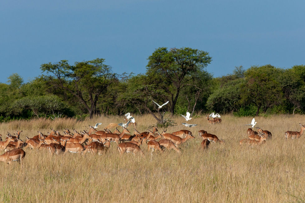
Sango Wildlife Conservancy is a property that forms part of the Save Valley Conservancy in Masvingo Province, Zimbabwe. This breathtaking conservancy spans ~340,000 hectares of Mopane, riverine, Acacia, Combretum woodlands, wetlands, and alluvial plains. Each of these unique vegetation types plays a crucial role in supporting large populations of wildlife, making it essential to conduct annual surveys to monitor their health and numbers. Habitat Horizons were contracted to conduct an oblique camera count (OCC) alongside the fixed-wing rear seat observer (RSO) count in order to compare methods.

In early September, the late dry season where the vegetation has not yet greened up, Brandon made the journey up to Sango. Armed with state-of-the-art surveying equipment, he mounted two cameras securely in a pod attached to the fuselage of a Savanna aircraft. The mission was ambitious: to capture detailed aerial images of wildlife across a vast expanse of land.
Transects were flown along fixed paths, and each camera captured a swath width of 350 m with a viewing angle between 30° and 60° on both sides of the aircraft. A sophisticated triggering system captured images at precise 3-second intervals, resulting in a staggering total of 16,082 images over the course of three flights, covering an expansive area of 610 km².

The next phase involved processing these images through a machine learning algorithm, specially designed for species detection and classification. Each animal detection generated by the algorithm underwent rigorous manual verification and classification by a dedicated team of trained wildlife annotators. Following this, two trained ecologists meticulously reviewed and validated the classifications to ensure the utmost accuracy.
Impala emerged as the most abundant species recorded in both the RSO and OCC surveys. The OCC survey revealed a remarkable 69% increase in the estimated impala population compared to the RSO survey. Kudu populations also saw a significant boost, with an 87% increase noted in the OCC survey relative to the RSO survey. The oblique camera count proved to be exceptionally effective for species including kudu, rhino, giraffe, and buffalo. Notably, rhino, giraffe, and buffalo populations experienced estimated increases of 67%, 68%, and 68%, respectively, compared to the RSO survey.
Finally, Habitat Horizons produced a detailed report that compared the OCC and RSO methods, including detailed distribution maps and comparisons of wildlife population estimates. Overall, the Sango survey was a pivotal contribution to the research and development of the OCC method and in turn Habitat Horizons.
Comments